Thousands of mappers gen alignment sheets with Lightning.
Lightning’s intuitive interface helps you create sheets fast and with minimal training. Intelligent features like Smart Tiles and Template Wizard can automate the complicated stuff, so you can focus on meeting your project deliverables.
Running ArcGIS Pro? Check out Lightning NexGen here.
Sheets made easy.
Lightning is designed to be easy to learn and to use, while also giving you all of the flexibility you need to meet your project requirements.
Use esri styles
You can use your esri styles that you are used to using. Text styles, and linear, point and polygon symbology all use native esri styles.
Any data source
Cut sheets from any data source that you have in the ArcMap Table of Contents.
Generate mxds or pdfs
Export your sheets with tons of options, including individual mxds or pdf files.
Smart moves faster.
Use Lightning’s built-in intelligence to speed up your workflow.
Smart tiles
Generate tile (matchline) locations instantly with Smart Tiles. This ensures every complicated corner of the line is visible in the Plan View. Use the Edit Tiles tool to customize for any unique requirements.
Smart scale calculations
Calculations such as stationing, linear distances and graph scales/ranges are automatically calculated and stored in the database.
Whitespace optimization
Lightning includes automated collision detection to understand when text elements overlap, and will prevent it. This reduces “clean-up” or manual editing of the sheets to virtually zero.
Design your template in minutes.
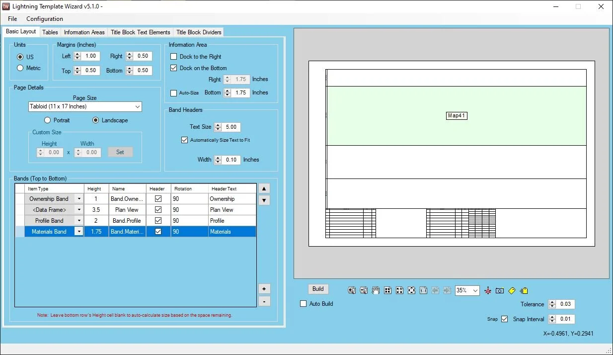
Lightning comes included with Template Wizard, where you can create simple or massively complex templates in minutes. Most users can create their template in about 15 minutes.
Bands, tables and more
Create, place and size any element that will hold data.
Make it look like yours
Add headers, rotate text and adjust virtually everything needed to meet your project specifications.
Export to mxt
Export your template to an mxt file where you can further customize in Arc if needed.
Lightning support has 99% customer satisfaction!
Bands upon bands.
Rapidly build bands for any kind of data on the line, crossing the line, or near the line.
Crossings
Any element that crosses the line can be scanned, calculated and drawn.
Materials
Scan materials from the map, or import them from your engineering group.
Graphs
Build advanced graphs for profiles, pipeline integrity, or anything else with a Z value.
2D and 3D stationing.
Lightning calculates linear referencing in 2D and in 3D and stores the values in a database. This way you can use either option.
Calculate stations for anything
Lightning will calculate stations for any point, line or polygon in your project. Even offset features will be given an offset station value. Additionally, all of this data is stored in a database. Attend our Blue Sky Certification course to learn how to extract and put this data to use in new and creative ways.
Equations made easy
Station equations are easily managed and applied. You can stack multiple equations on top of each other. And if you’ve made a mistake, you can always revert back to the original station values.
Open database
All project data, include station values, is stored in a database. Not only can you open and explore this database, we’ll train you how to build custom reports and workflows off of it.
Integrated with Skyline, DASH and Orbital.
Lightning uses the Blue Sky database, which makes your data compatible with workflows from groups throughout your company, and your client.
Pull from Orbital’s cloud data.
Lightning can connect to Orbital Projects to use the latest field data and centerline. No more sifting through email attachments, or navigating old folders on an FTP.
Push and pull data with CAD.
With Lightning and Skyline working in tandem, CAD and GIS groups can collaborate like never before.


